
Patek Philippe introduces a brand new collection named Cubitus

AHS Properties marks a milestone with an AED 130mln sale of its “Searenity” Villa on Palm Jumeirah

The Milestone 10th edition of Dubai Design Week is now open

"The 1001 Seasons of Elie Saab" event dazzles Riyadh Season with Glamour

DAMAC Properties unveils DAMAC Islands, inspired by most desirable global island destinations


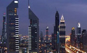
DubaiSat-2 captures high-definition photos of new Dubai Water Canal full of water
By viji Monday, 07 November 2016 5:14 PM

DubaiSat-2 detects the completion of construction on Dubai Water Canal
DubaiSat-2, owned and operated by the Mohammed bin Rashid Space Centre (MBRSC), has captured a high definition photos of the Dubai Water Canal full of water. The photos show the new waterway flowing from Dubai Creek down towards the Arabian Gulf. The image also show the various facilities built to run along both banks of the canal and the areas surrounding it, which consist of residences, malls, hotels and recreational centres.
DubaiSat-2 provides high quality satellite images to several institutions within the UAE and internationally, for urban planning and mapping, monitoring environmental changes and disaster management. The satellite’s camera features a 1-metre panchromatic resolution and a 4-metre multi-spectral resolution (coloured images). It can store 512 images, each 12km x 12km in size. DubaiSat-2 was launched in 2013 via the Dnepr at Yasny Cosmodrome to circulate a sun-synchronous orbit, 600km in altitude.
The DubaiSat-2 was launched in 2013 through the Dnepr in Yasny Cosmodrome to circulate a sun-synchronous orbit, 600 km in altitude.


Add new comment